See Our Applications
Geomatex provides integrated solutions based on its huge portfolio of services.
Agriculture
-
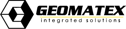
Precision Agriculture
Creating crop maps and farm 3d model allow for advanced crop management and monitoring. Aerial multispectral imaging has become an important tool for crop management. It is a non-invasive way to detect plant diseases and monitor nurseries and greenhouses. In addition to that, precision spraying and spreading drones are revolutionizing resource management including time.
Construction
-
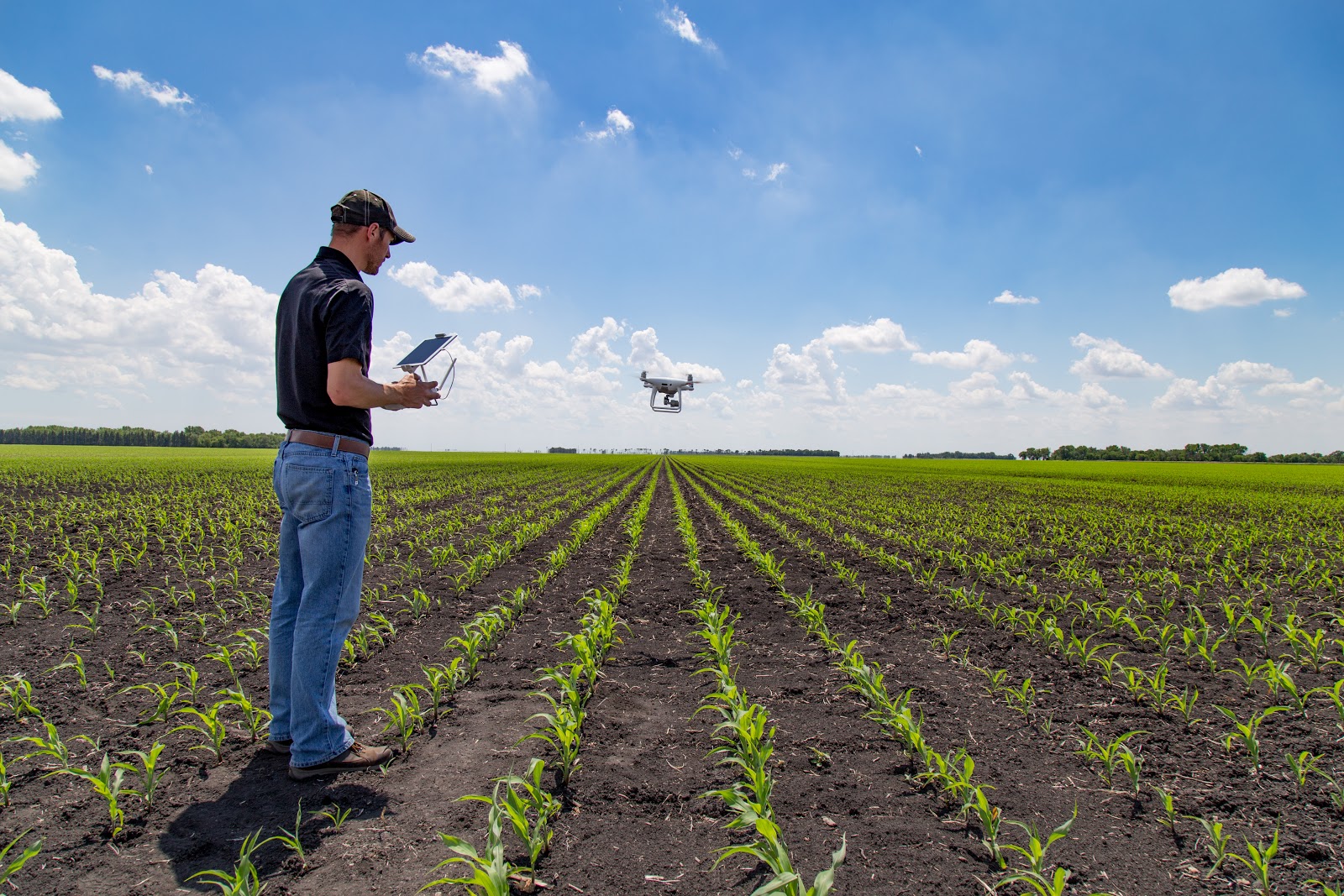
BIM Modeling
BIM Modeling Using 3D Laser Scanning Services
Laser scanning is an ideal technology for Building Information Modeling (BIM) due to its efficiency, accuracy, and level of detail. Laser scanning accurately documents as-built conditions and proves to be invaluable in facility asset management and modifications. Laser scanning can also be used for reality capture and augmented reality in many aspects of architecture, construction and engineering.
Energy
-
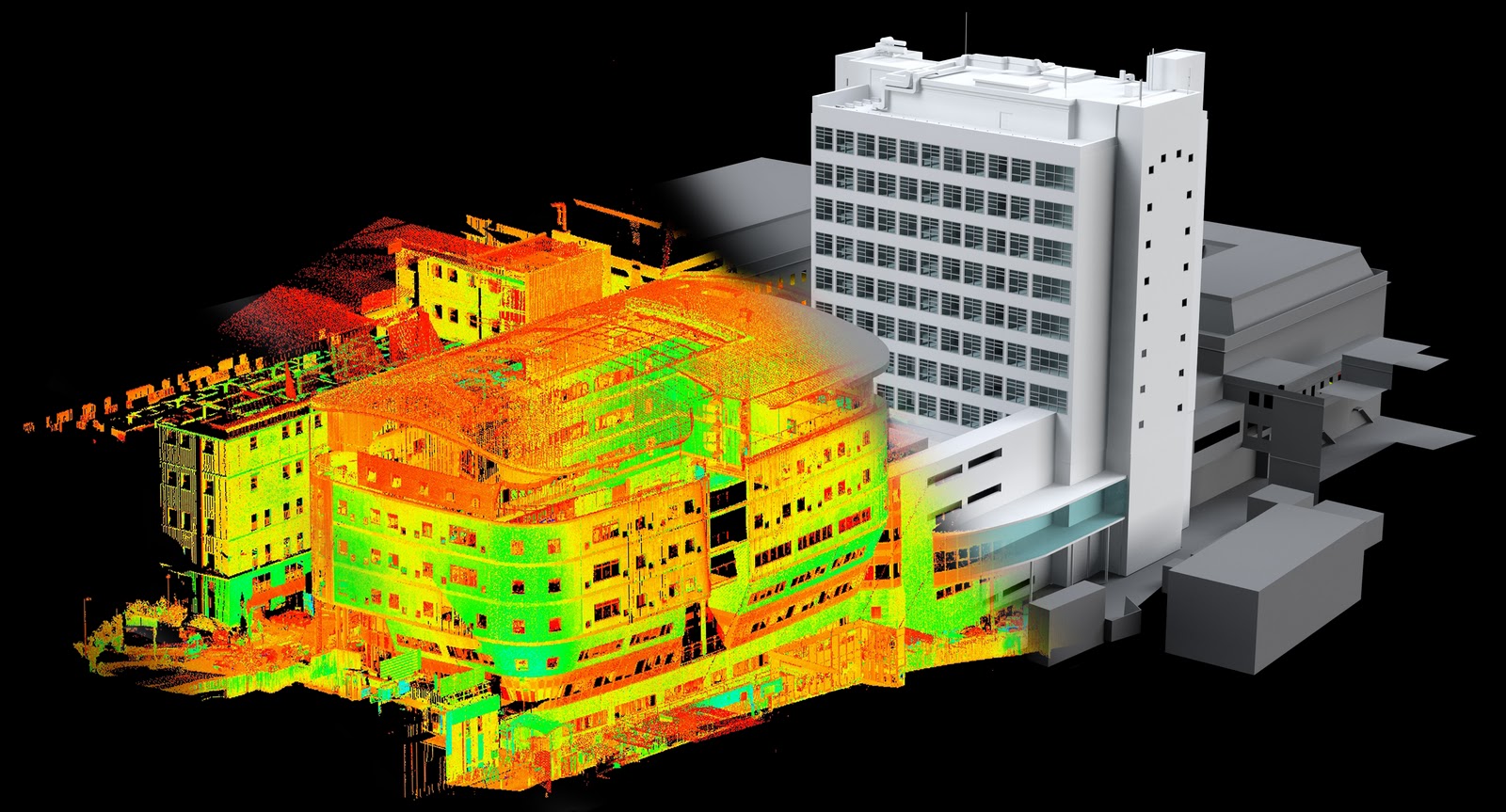
Remote control of oil and gas pipelines
UAVs in oil industry
•Detection of leaks;
•Real-time mapping;
•Detection of tie-ins;
•Twenty-four-hour patrolling;
•Orthophotomaps;
•Monitoring of progress at construction and reconstruction sites based on the data of unmanned aerial surveillance.
Aerial photography in oil industry is used to:
•Monitor environmental pollution (both land and water);
•Monitor technical state of different objects near pipelines, find increased pipeline wear;
•Predict probable leaks of natural gas and oil;
•Detect accurate geographical location of pipeline accidents. -
Solar Applications
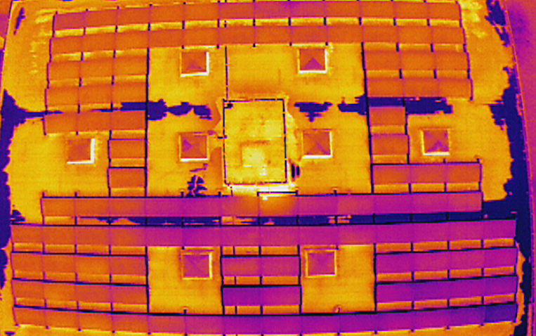
The DJI Zenmuse XT camera offers many advantages for rooftop solar panel inspectors and operators of massive solar farms. In addition to being able to clearly view temperature anomalies on a crisp thermal image, the Zenmuse XT can be used to scan installed solar panels during normal operation across large areas within a short time frame. This allows problem panels to be isolated quickly, ready for remedial action, keeping energy production at optimum levels. Attached to a DJI M100, the XT will have a flight time of over 30 minutes, allowing for the inspection of large sites in a single flight. DJI’s Inspire series when combined with either its Zenmuse X3 or X5 cameras provide solar energy plants the ability to inspect an array of panels at speed. Instead of sending inspectors out into the plant to check individual panels on foot, a flight overhead recorded using 4K video provides the image clarity needed to carry out initial inspections. Inspectors then are only required to investigate problem areas, significantly increasing their efficiency and productivity.
-
Power Line
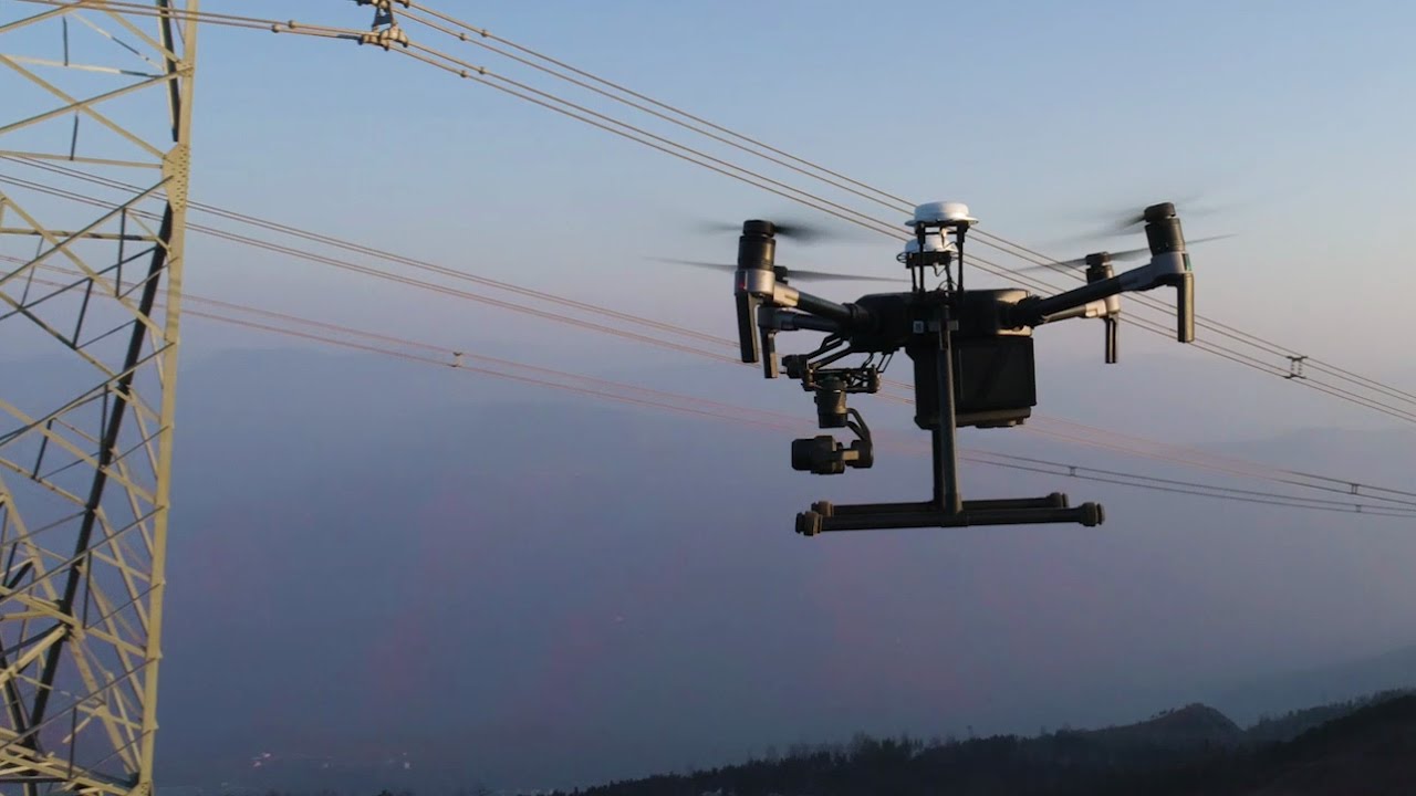
Power lines spanning vast distances are the circulatory system of modern power grids. They present unique maintenance challenges due to their geographical dispersion, as well as their height. Traditionally inspected by helicopter-based methods, they can be more easily and efficiently inspected using UAVs Inspection teams equipped with a DJI Inspire PRO, equipped with DJI’s Zenmuse X5 Micro Four Thirds camera are able to begin aerial inspections mere moments after arriving on site. Capable of capturing 16 megapixel photos and 4K video the images these cameras capture are detailed enough for fine post-inspection analysis while the live feed will allow operators to see significant problems as they fly. The DJI M600 series heavy lifter platform, combined with the DJI Ronin-MX gimbal provides inspection teams with the capability to deploy heavy, large sensor cameras needed for more specialized work. Powered by the new A3 flight controller, it can be upgraded with DJI’s D-RTK GNSS system for centimeter level hovering accuracy. Two additional satellite and IMU systems can also be added, creating a total of six layers of redundancy to ensure it flies with absolute reliability at all times. Its support of DJI’s SDK allows it to be customized to simplify inspection, from standardized flight patterns to fully autonomous flight, and a base station can also be used to allow the control of up to 5 aircraft simultaneously to make inspecting different line segments simultaneously possible.
Infrastructure
-
Water / Wastewater Treatment Plants
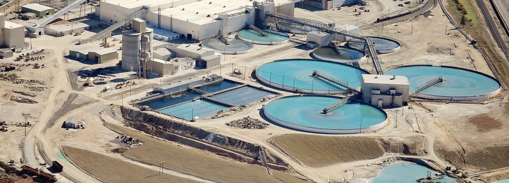
Geomatex is experienced in providing 3D laser scanning services for water and wastewater infrastructure. We have seen facilities from 40 MGD to 1 BGD and can high definition laser scan the interior and exterior of buildings; foundations; structural, mechanical, electrical and plumbing features; equipment, motors, conduit and piping down to ½ inch diameter. We can work directly for municipalities, Engineering firms and privately owned facilities.
-
Mapping
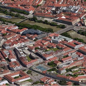
If you are a mapping or surveying professional, new technologies have significantly changed the way that you can conduct your work. Barely in our thinking a few years ago, technologies such as UAVs, drones, 3D surveying, laser scanning, and 3D imaging are now essential to your work. You will benefit from solutions that leverage these capabilities, enabling innovative ways to automate, analyze, and visualize your work and providing exciting new deliverables that you can offer to your clients.
You also face an increasingly competitive market to deliver your services, as these new technologies have attracted new players. They have changed the expectations of your clients, yet opened up new applications and opportunities.
Our reality modeling solution allows you to rapidly build a highly precise 3D geometric model of your existing terrain or infrastructure. Use digital imagery captured from any source, including UAVs, aircraft, or handheld digital cameras. Or, if it better suits your project, use our point-cloud solution.
Our reality modeling capabilities underpin our established offerings for cadastral and base mapping, site planning and design, civil engineering, utility planning and design, and GIS. Manage your work processes and your project deliverables with our spatially enabled information management environment.
No matter your focus, you will benefit from Bentley’s solutions for mapping and surveying, and empower your team to create highly accurate and data-rich deliverables.
-
Railways Inspection
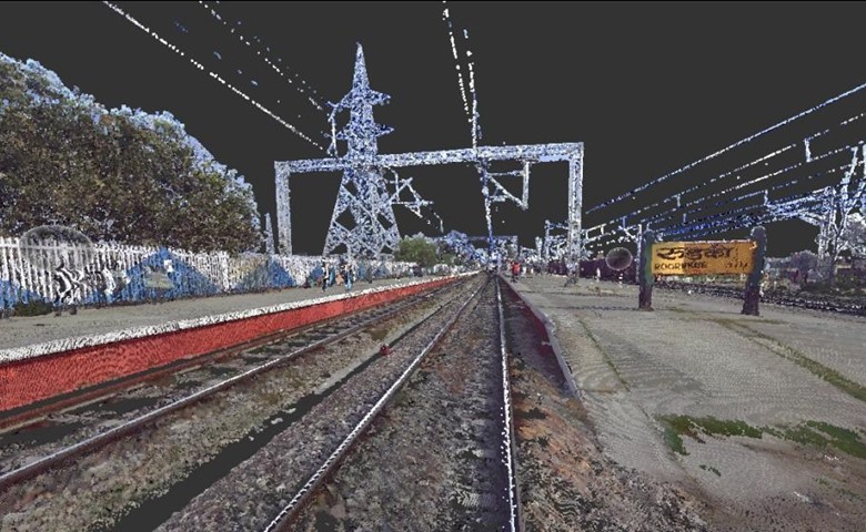
In rail applications, Z+F 2D laser scanners are not only used for rail track surveying but also for capturing objects alongside the track like buildings, tunnels, bridges or other objects which might cause a potential danger for rail traffic.
The high resolution surveying of objects like station platforms or tunnels is necessary for clearance analysis or analysing tunnel walls. When carrying oversized loads a preflight can be performed to detect narrow points.
Due to the high measurement rate and the high rotation speed Z+F measurement systems are highly suitable for rail applications. Therefore, very short distances between profiles can be realised. The Z+F PROFILER® 9012’s rotation speed for example is 200 rps.
For special requirements Zoller + Fröhlich always offers customized solutions like the Z+F PROFILER® 6007 duo. We in Cooperation with Our Partner we Z+F 2D laser scanners are not only used for rail track surveying but also for capturing objects alongside the track like buildings, tunnels, bridges or other objects which might cause a potential danger for rail traffic.
The high resolution surveying of objects like station platforms or tunnels is necessary for clearance analysis or analysing tunnel walls. When carrying oversized loads a preflight can be performed to detect narrow points.
Due to the high measurement rate and the high rotation speed Z+F measurement systems are highly suitable for rail applications. Therefore, very short distances between profiles can be realised. The Z+F PROFILER® 9012’s rotation speed for example is 200 rps.
For special requirements Zoller + Fröhlich always offers customized solutions like the Z+F PROFILER® 6007 duo. -
Road and Highway Networks
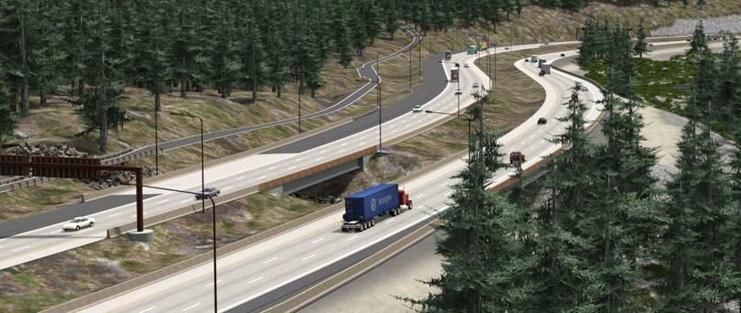
Your infrastructure is essential to sustaining economic growth and improving quality of life. Our solutions address the entire transportation lifecycle, spanning planning, design, analysis, maintenance, and operation of roads, bridges, tunnels, drainage systems, and roadway assets.
Our Partner Bentley has provided solutions to highway agencies for over three decades. Our solutions are proven, trusted, and reliable, and will help you to create, manage, and renew your road assets on budget and on schedule.
Media
-
3D video Gaming
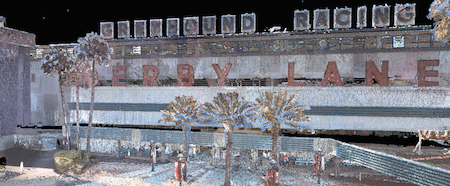
Creating more realistic and more engaging video games is easier with the use of 3D laser scan technology. TruePoint can take real-world objects and spaces and create dimensionally accurate computer versions of them. Millions of data points are collected with laser scanners providing software developers with an incredible amount of detail. The speed of laser scanning allows for locations to be captured in 3D quickly. Check this video as an example.
-
JOURNALISM
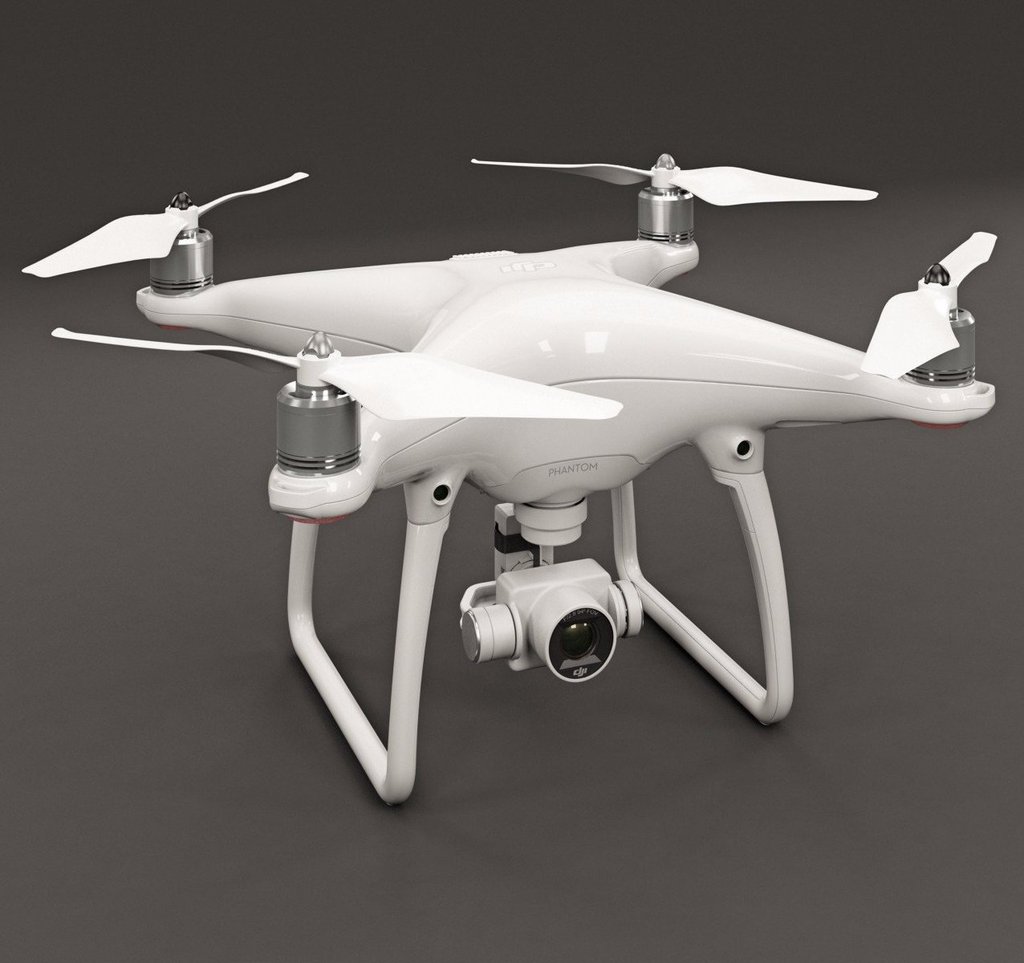
Traditionally, aerial news footage required dispatching expensive news choppers. Today, with a DJI Phantom, a journalist can have their aerial camera in their backpack wherever they go ready for the moment they need an aerial shot. In situations where a journalist requires higher quality imaging than a Phantom the DJI Inspire Pro, equipped with the DJI Zenmuse X5 gives journalists 16 megapixel images and dynamic, clear 4K video. Through an add-on on the Phantom, or natively on the Inspire, connections are provided that allow a journalist to connect their aircraft directly to broadcasting systems to broadcast aerial footage live across the world. On the ground, news reports are traditionally static shots, with journalists limited by heavy equipment and no simple means to move the camera smoothly. Using the DJI Osmo, a journalist can now follow the story as it moves or take viewers through a scene while maintaining smoothness and clarity. Like the DJI Inspire, the Osmo can be upgraded with the Zenmuse X5 camera for higher imaging quality.
-
CINEMATOGRAPHY
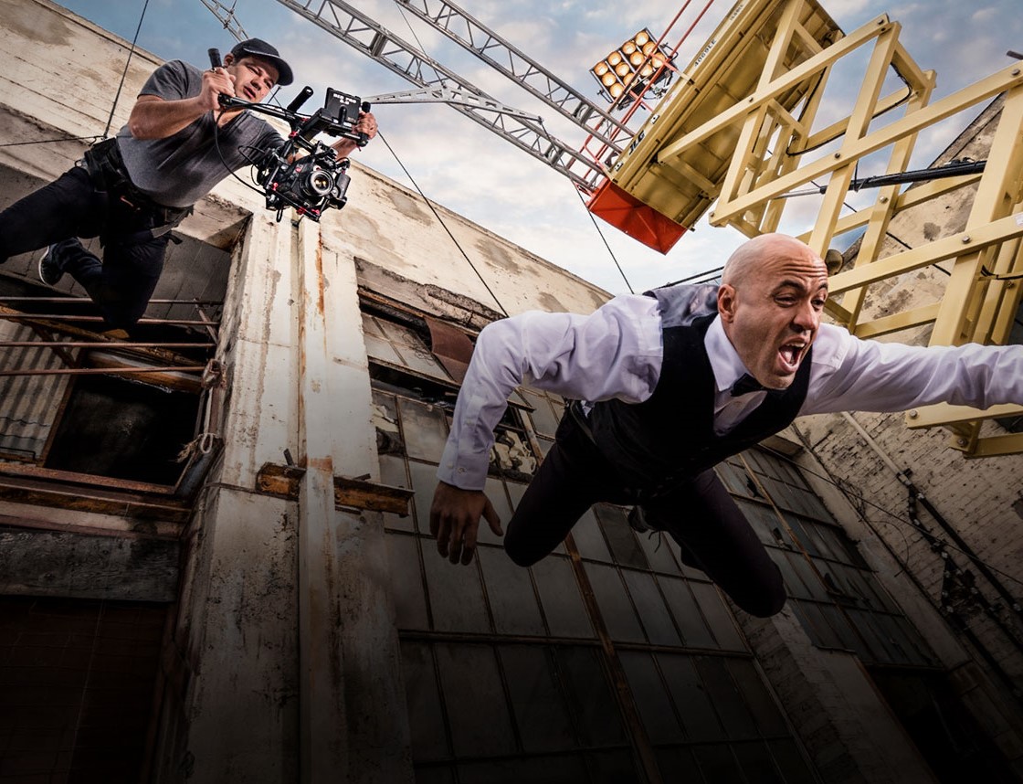
Developed for the filmmaking professional, the DJI Ronin series are a powerful handheld camera stabilization systems that use custom sensors, powerful motors and advanced algorithms to put world-class precision in the hands of film makers. The Ronin is designed for elite level film making where heavy, cinema grade camera and lens combinations are required including the RED EPIC or the ARRI ALEXA. The more lightweight Ronin-M is designed for lighter camera and lens combinations including Micro Four Thirds and DSLR cameras, and can even carry the RED EPIC and ARRI ALEXA Mini provided that lenses are within weight and balance limits. Created for high-G environments, the Ronin-MX is carries a similar range of cameras as the Ronin-M, but is optimized to withstand G forces. It is ideal for smooth footage from moving vehicles and even the DJI M600 heavy lift aircraft.
Special Applications
-
Special Applications
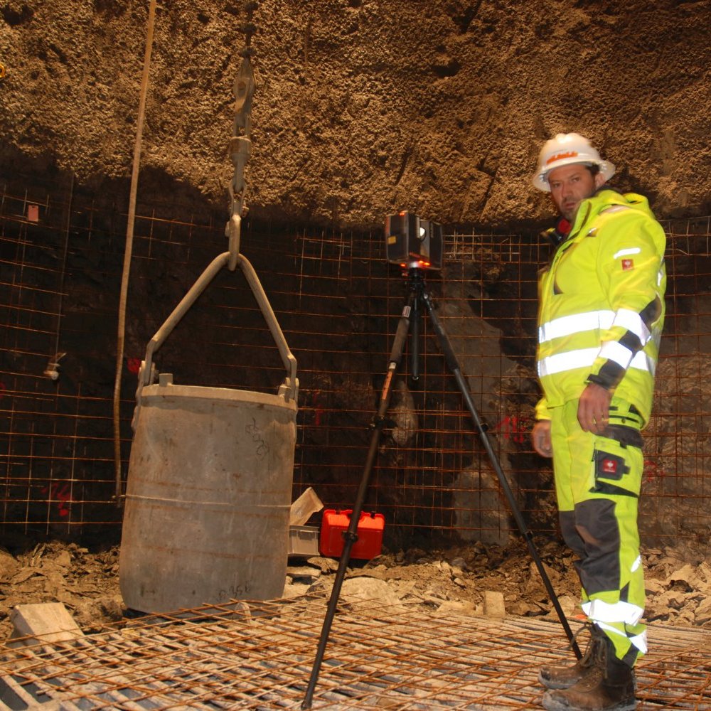
Some projects require special applications due to limitations within the physical setting. Often times this is due to line-of-sight issues and when a scan must be done safely from the ground or with precautionary distance. Some of these applications would include above-ceiling Mechanical, Electrical and Plumbing (MEP) features in hospitals where it is necessary to maintain negative airflow or interstitial spaces that are congested with limited access. Since laser scanning is a non-contact measurement tool (i.e. we can scan from a safe distance or location) this becomes a powerful tool for solving these complex challenges.