What We Do
Geomatex is a highly experienced team of Reality Modeling professionals who promise to deliver exceptional service to every client. We remain on the front end of technology and use only state-of-the-art equipment and software.
Geomatex is a highly experienced team of Reality Modeling professionals who promise to deliver exceptional service to every client. We remain on the front end of technology and use only state-of-the-art equipment and software.
-We offer nationwide service and have worked in many different industries. Our consultative approach ensures you get the right information so you can use it to make informed decisions now and for future projects. Our team of in-house engineers, architects and CAD technicians all have "real world" experience in their respective disciplines and work with point clouds every day to create deliverables that are practical and useful. We can build models to any level of detail.
Our in-house team of engineers and architects work with each client to make their project successful. This team of experts delivers custom and cost-effective solutions for each project.

Capture. Analyze. Define. That is what we do at Geomatex
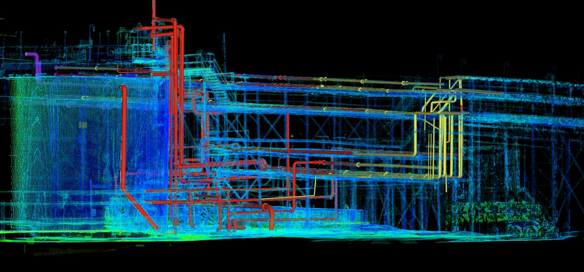
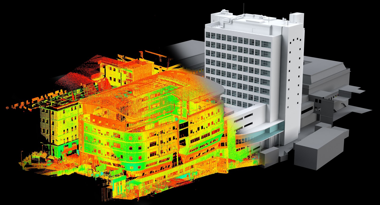
Laser scanning services involve the use of laser scanners to capture accurate and detailed three-dimensional (3D) representations of physical objects or environments. These services are commonly used in various industries, including architecture, engineering, construction, surveying, and manufacturing. Laser scanning technology can quickly and precisely collect large amounts of data, making it valuable for projects that require detailed spatial information.
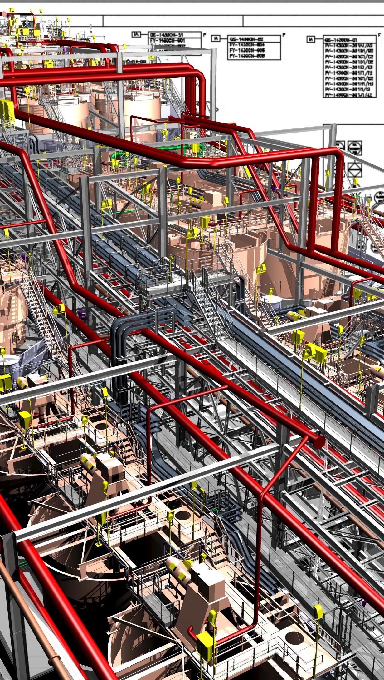
Geomatex is experienced in providing 3D laser scanning services for Power, Process and Plant applications to produce reliable, high-quality data that can be used across your organization. We can high definition laser scan the interior and exterior of buildings; structural, mechanical, electrical and plumbing features; furnaces, equipment, conduit and piping down to ½ inch diameter.
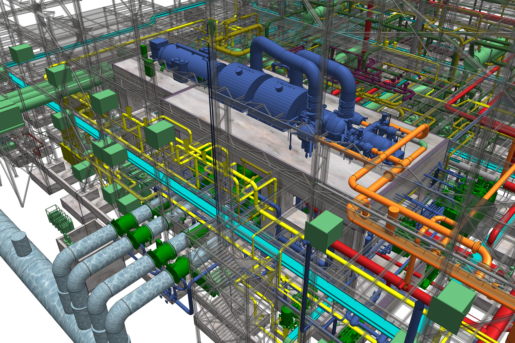
CAD to BIM (Building Information Modeling) service involves the transformation of data from a traditional CAD (Computer-Aided Design) format into a BIM environment. CAD files typically represent 2D or 3D geometry, while BIM encompasses a broader spectrum of information, including geometry, spatial relationships, geographic information, quantities, and properties of building components.
BIM (Building Information Modeling) services encompass a range of offerings centered around the creation, management, and utilization of digital representations of buildings or infrastructure projects. These services leverage BIM software and methodologies to facilitate collaborative, efficient, and data-driven workflows across the lifecycle of a construction project
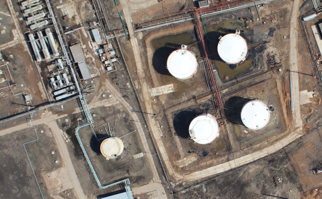
Using drones as a service (DaaS) allows companies the opportunity to access drone technology and services without the need to purchase, maintain, or operate the equipment themselves. Drones can perform a variety of tasks, such as aerial photography, surveillance, inspection, mapping, delivery, and more.
Scan Before You Plan:
By incorporating 3D laser scanning in the beginning stages of a project, clients are able to realize even greater value and benefits. A scan done early in a project allows the design process to be accelerated because the scan provides a large amount of important as-is information up front. For example, providing the scan data to subcontractors as part of the RFQ package allows the subcontractors to provide a complete and accurate dollar figure. Accordingly, everyone involved in the project--including the architects, engineers, and contractors--are able to plan their project work, which, in turn, reduces potential clashes before the final design and construction begin. Thus, having more precise and definite information at the pre-planning phase allows for better planning throughout the whole project.
Geomatex is a highly experienced team of Reality Modeling professionals who promise to deliver exceptional service to every client. We remain on the front end of technology and use only state-of-the-art equipment and software.