DJI Enterprise is a global team dedicated to developing world-class drone solutions for agriculture, energy, public safety, survey, mapping, and more
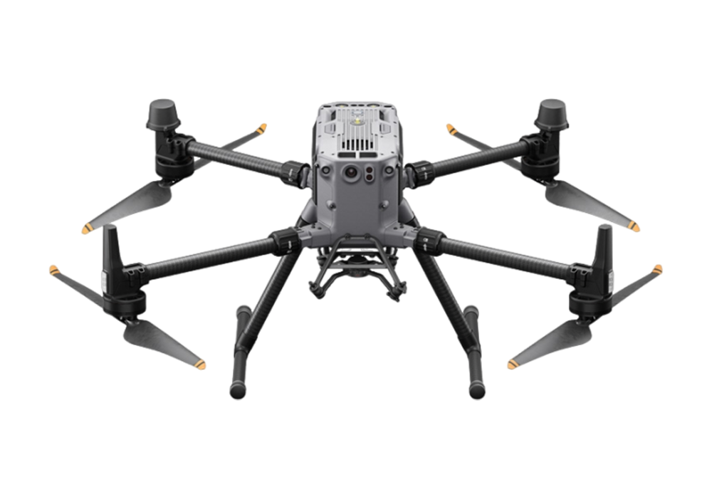
Matrice 4E
The DJI Matrice 4E sets a new standard for aerial mapping, boasting extended flight durations, faster speeds, and intelligent features. With advanced capture modes for efficient coverage and precise distortion correction for accurate outputs, it’s designed for excellence. Smart 3D Capture and enhanced obstacle avoidance simplify the creation of detailed models, making it an indispensable tool for professionals..
See More
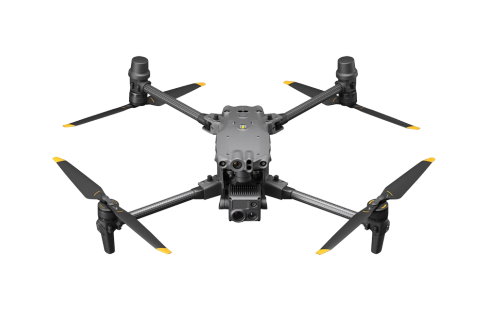
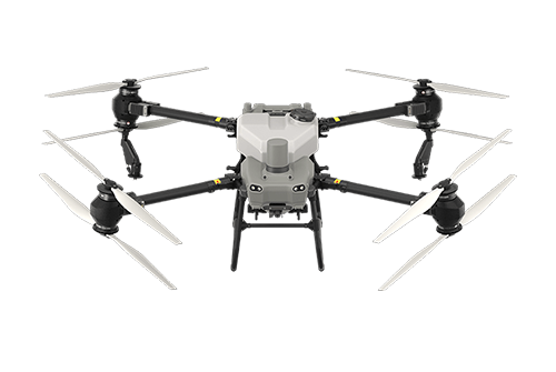
Matrice 4T
The DJI Matrice 4T is a cutting-edge solution tailored for industries like energy management emergency response and public safety. Equipped with a high-resolution infrared thermal camera, a powerful NIR auxiliary light with a 100-meter range, and a 24mm wide-angle lens, it ensures crisp visuals both day and night, empowering critical missions with reliability and precision..
See More
Dock 3
DJI Dock 3 empowers 24/7 remote operations and, for the first time, supports mobile vehicle-mounted deployment, effortlessly adapting to various environments. The drones utilize the same cameras as the Matrice 4 Series but offer improved flight and protection performance. They can also pair with DJI RC Plus 2 Enterprise for standalone use. With DJI FlightHub 2's intelligent features, pilots can significantly cut down on operational time and labor costs, maximizing efficiency and savings..
See More
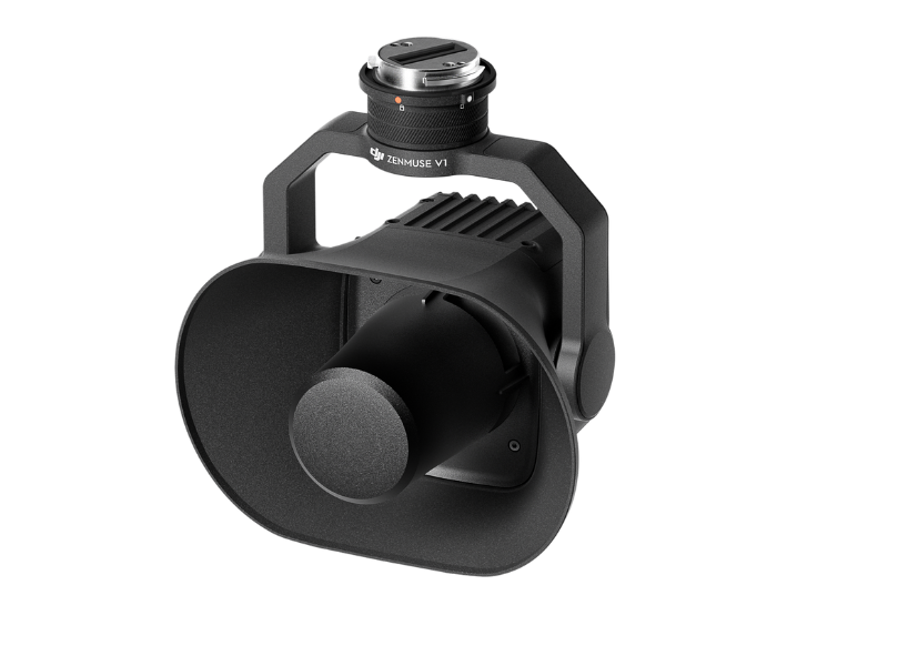
Zenmuse V1
The DJI Zenmuse V1 is DJI’s first dedicated loudspeaker payload for enterprise drones, announced on April 16, 2025. Designed for the Matrice 300 RTK and Matrice 350 RTK platforms, it enhances aerial communication capabilities for public safety, emergency response, and industrial operations.
See More
Zenmuse S1
The DJI Zenmuse S1 is DJI’s first high-intensity spotlight payload designed for enterprise drones. Compatible with the Matrice 300 RTK and Matrice 350 RTK platforms, it enhances nighttime operations such as search and rescue, infrastructure inspections, and emergency response.
See More
Matrice 400
Flagship drone platform, boasts an impressive 59-minute flight time, a payload capacity of up to 6 kg, and integrated rotating LiDAR and mmWave radar for power-line-level obstacle sensing. It also supports the O4 Enterprise Enhanced Video Transmission and Airborne Relay Video Transmission , ensuring safer handling and easier operations. Combining Smart Detection with visible and thermal imaging, AR projection, ship-based takeoff/landing, and advanced automation, Matrice 400 excels in emergency response, power inspections, mapping, and AEC..
See More
Matrice 350 RTK
The Matrice 350 RTK sets a new benchmark for the industry. This next-generation drone platform features an all-new video transmission system and control experience, a more efficient battery system, and more comprehensive safety features, as well as robust payload and expansion capabilities. It is fully powered to inject innovative strength into any aerial operation.
See More
Matrice 30T
The DJI Matrice 30T is a versatile commercial drone featuring an integrated payload with a 48MP wide camera, a 12MP tele zoom camera, and a thermal camera for diverse operational needs. It offers advanced flight performance, easily handling challenging weather with an IP55 rating, and ensures safety with comprehensive sensors and collision avoidance systems.
See More
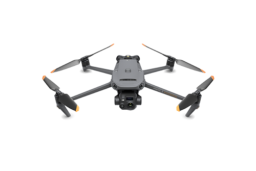
Mavic 3 Enterprise Series
The DJI Mavic 3E and DJI Mavic 3T are the most comprehensive improvement to the world’s compact drone offerings in three years, boosting performance in every area and providing professional users with best-in-class, safe, and efficient aerial technology to help them succeed in their everyday missions. Thanks to their impressive flight time of 45 minutes, they are ideally suited for lengthy assignments.
See More
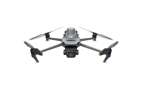
Mavic 3 Multispectral
The DJI Mavic 3 Multispectral enhances precision agriculture, capturing crop growth information for more effective and productive crop production worldwide. Its advanced tools cater to individuals and organizations engaged in precision agriculture.
See More
AGRAS T50
DJI AGRAS T50 elevates drone agricultural operations to new heights. It inherits a powerful coaxial twin-rotor propulsion system and a split-type torque resistant structure for next level stability when carrying 40 kg spraying or 50 kg spreading payloads. DJI AGRAS T50 leverages a Dual Atomizing Spraying System, Front and Rear Phased Array Radars, and a Binocular Vision System. DJI AGRAS T50 excels across multiple scenarios, from surveying to spraying and spreading, guaranteeing stable operations and steady performance.
See More
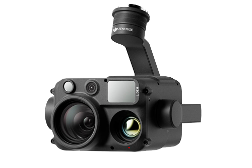
Zenmuse H30T
The all-weather, multi-sensor flagship Zenmuse H30 Series integrates five major modules—a wide-angle camera, a zoom camera, an infrared thermal camera, a laser range finder, and an NIR auxiliary light.
See More
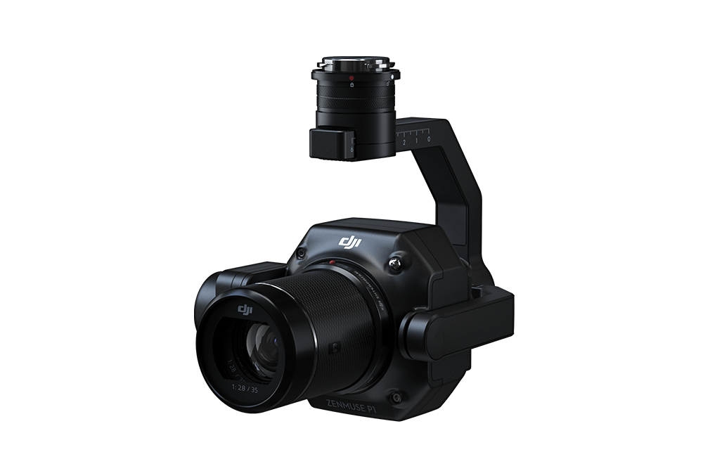
Zenmuse P1
The Zenmuse P1 revolutionizes aerial surveying for the DJI Matrice 300 System, introducing full-frame photogrammetry. Featuring a 45 MP full-frame sensor on a versatile 3-axis gimbal, it enables quick focal length changes for precise detail capture in aerial imaging.
See More
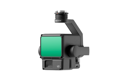
Zenmuse L2
Zenmuse L2 integrates frame LiDAR, a self-developed high-accuracy IMU system, and a 4/3 CMOS RGB mapping camera, providing DJI flight platforms with more precise, efficient, and reliable geospatial data acquisition. When used with DJI Terra, it delivers a turnkey solution for 3D data collection and high-accuracy post-processing.
See More
FlyCart 30
DJI FlyCart 30 is here to deliver the goods. A long-distance heavy lifter with powerful signal and intelligence, DJI FlyCart 30 supports Cargo mode and Winch mode and ascends beyond traditional logistical limits to deliver a safe, economical, and efficient air transport solution.
See More
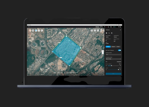
DJI Terra
Capture, analyze and visualize your environment with DJI Terra – an easy to use mapping software developed to help industry professionals transform real-world scenarios into digital assets.
See More
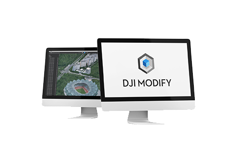
Modify
DJI Modify is DJI’s first intelligent 3D model editing software. It features a streamlined and intuitive interface that makes it simple to complete model editing efficiently. Paired with a DJI Enterprise drone and DJI Terra, it forms a comprehensive solution from aerial surveying, modeling, and model editing to sharing these models easily to meet operational needs in surveying and mapping, firefighting, emergency response, and transportation.
See More


.png)
.png)
.png)