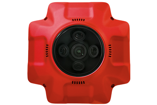
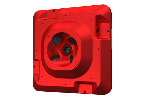
102S Series
The 102S five-lens aerial oblique camera, designed by SHARE UAV, is a new generation mapping camera can realize drone surveying and mapping with no GCPs used. Camera is seamless docking with DJI Matrice 300 RTK through SkyPort. Using CNC designed housing makes PSDK 102S have better heat dissipation, smaller wind resistance coefficient, stronger structure, which is more conducive to aerial survey flight. Besides, PSDK 102S also has intelligent self-test, one-key reset, intelligent heat dissipation, real-time image transmission and other functions.
See More
PSDK 102S V3
The SHAREUAV PSDK 102S V3 is a high-performance aerial survey camera featuring a 3-axis stabilized gimbal, 125-megapixel sensors, and advanced image control systems for precise, ultra-high-resolution data capture. It includes real-time terrain-following adjustments, compatibility with various UAV platforms, and durability with a global shutter. This system is designed for professional-grade surveying, excelling in tasks like 3D mapping, slope modeling, and oblique photography.
See More
Slam 10
This advanced LiDAR system features a 20° tilted setup for improved ground-to-ceiling coverage, dual 135° cameras for wide-angle imagery, and a built-in RTK module for centimeter-level precision. It excels in GPS-denied environments with the SHARE-SLAM-RTK algorithm and supports real-time point cloud processing with microsecond synchronization. The system also includes user-friendly features like single-handed MagSafe operation, Apple Vision Pro compatibility, and the SHARE Mapper app for seamless point cloud previews, making it an efficient tool for precise 3D mapping.
See More
202 Pro
Share 202S series, a new possibility for the professional aerial survey was born specifically for urban projects. When the GSD is 5 cm, the altitude can reach up to 442 meters. Equipped with the current mainstream UAV mounting platform, it can easily fly over high obstacles, reduce the flying risk during field data acquisition, and let you work safely in the city with high-rise buildings. Flagship full-frame sensor, 210 million effective pixels in total. Retain the rich details of the image, to achieve true urban data acquisition and restoration. Present the real city scene and help build high-quality digital assets.
See More
303S Pro
The 303S Pro boasts 5 full-frame Exmor R CMOS image sensor, higher photographic area, higher picture quality performance, the pursuit of real data collection reduction limit, 305 million pixel integration, clearer photos, richer details, so that the real 3D and reality synchronization.
See More


.png)
.png)


