
portfolio
Building Information Modeling (BIM)
BIM (Building Information Modeling) services encompass a range of offerings centered around the creation, management, and utilization of digital representations of buildings or infrastructure projects. These services leverage BIM software and methodologies to facilitate collaborative, efficient, and data-driven workflows across the lifecycle of a construction project.
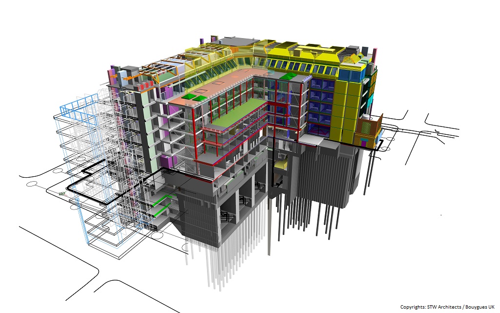
BIM modeling involves creating detailed digital representations of a building or infrastructure project using specialized BIM software. These models go beyond simple 3D visualization; they contain a wealth of information about the project's elements, including geometry, spatial relationships, geographic information, quantities, and properties.
BIM modeling enables collaborative work among multiple disciplines involved in a construction project, allowing for better coordination, reduced errors, improved efficiency, and enhanced decision-making throughout the project's lifecycle—from design and construction to facility management and maintenance. BIM models can contain different levels of detail, ranging from basic conceptual representations to highly detailed models that include specific information about each building component.
What is a LOD?
In CAD to BIM services, LOD determines the extent of information and geometry carried over from the original CAD files into the BIM environment. The LOD framework categorizes the level of detail in a BIM model, guiding the expectations and understanding of what information is available at each stage of the design and construction process.
There are various LOD levels, typically ranging from LOD 100 (basic representation) to LOD 500 (highly detailed and specific). Each level corresponds to the amount of detail, accuracy, and information embedded in the BIM model. For instance, at LOD 100, basic geometrical representations exist, while at LOD 500, detailed information like manufacturer details, maintenance schedules, or specific component data might be included.