portfolio
The Lafarge Project Drones
About the project
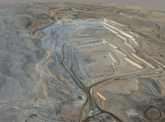
The project involved surveying multiple quarries in the Ain El Sokhna region to produce high-resolution 3D models and conduct stockpile volume and haul road analyses. The expansive area and challenging terrain required careful planning to meet the client’s specifications, including a maximum ground sampling distance (GSD) of 3 cm/pixel for precise measurements and actionable insights.
Requirements
- High-resolution 3D models of the quarry region.
- Accurate stockpile volume and haul road analysis.
- GSD of 3 cm/pixel for detailed surveying.
The survey utilized a DJI Matrice 300 drone with a Zenmuse P1 payload. Images were processed into 3D models using Bentley iTwin Capture Modeler, and Alteia AI software was employed for advanced analyses, including stockpile volume calculations and haul road assessments, delivering results that exceeded client expectations.
Technologies used: DJI and Bentley Systems.

